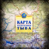
 The first map of Tuva showing all the known touristic attractions has been released. The map indicates the locations of wildlife sanctuaries, cultural sites, the most popular routs, tracks, mineral springs (arzhaans), fishing, hunting, rafting spots etc
It also demonstrates the infrastructure of the region, including residential areas, roads, tourist camps, motels, cafes, petrol stations. The backside of the map contains pictures and materials of Tuva.
The map was presented as part of the opening of the inter-regional fair “Community: Tuva-Khakasia-Krasnoyask krai”.
There are only 2000 copies printed, but in the long term, the number is to be increased as well as the online version is to be available.
The map indicates more than 40 touristic attractions of the republic, and, as explained by the head of the Tourism Department Kandemir Mongush, it has been based on the recent government supported project “Tos-Ertine” or “Nine Treasures of Tuva”.
While making the map, the creators were also addressing to the data provided by the Directorate of the specially protected natural sites of Tuva, the Tourist Association of RT, Department of Transportation of RT as well as the academic institutions and others.

